


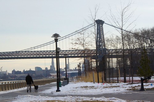
 Suzanne Rozdeba The East River Park is the focal point of an unrealized plan for a unbroken protected greenway on Manhattan’s east side. Below: The park, renamed for former Mayor John V. Lindsay in 2001, is also a hub for runners and cyclists.
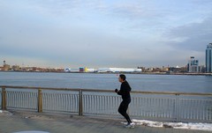
Before the construction of the East River (later FDR) Drive and the public housing along the east side of the street, Avenue D’s relationship with the East River was much more direct than we see now. When the area was still dominated by an active industrial waterfront, almost every east-west street in the neighborhood flowed directly into the river. Today, only a couple of those streets give access to the waterfront and the FDR must be traversed first.
Indeed, a quick look at some historical photographs and maps shows that the water was physically much closer to Avenue D than it is today. For instance, if you stood on the corner of 13th Street on Avenue D in the 1930’s, you could look directly at the water lapping up against the dock, while today that view is dominated by a power plant. Meanwhile, a walk from the corner of East Sixth street and Avenue D would deliver you to the water’s edge after approximately 900 feet, and the equivalent walk today is about 350 feet longer.
The difference, of course, is due both to FDR Drive and the East River Park (renamed John V. Lindsay Park in 2001). What the neighborhood lost in direct access to the water, it gained in additional open space. In fact, it gained Manhattan’s biggest open space south of 59th Street. The park, which is almost 60 acres in size and stretches from East 12th Street to Montgomery Street, owes its origins to the FDR Drive and Robert Moses, the man behind almost every piece of serious infrastructure conceived and/or constructed between the Great Depression and the city’s financial crisis of the 1970’s.
Read more…
